Lagoa do Fogo: guia completo para visitar a lagoa mais selvagem de São Miguel
Escondida na cratera do vulcão de Água de Pau, a 580 metros de altitude, a Lagoa do Fogo tem umas águas de um azul tão intenso que parece irreal. Guia completo com trilhos, acesso shuttle de verão e dicas para a melhor visita.
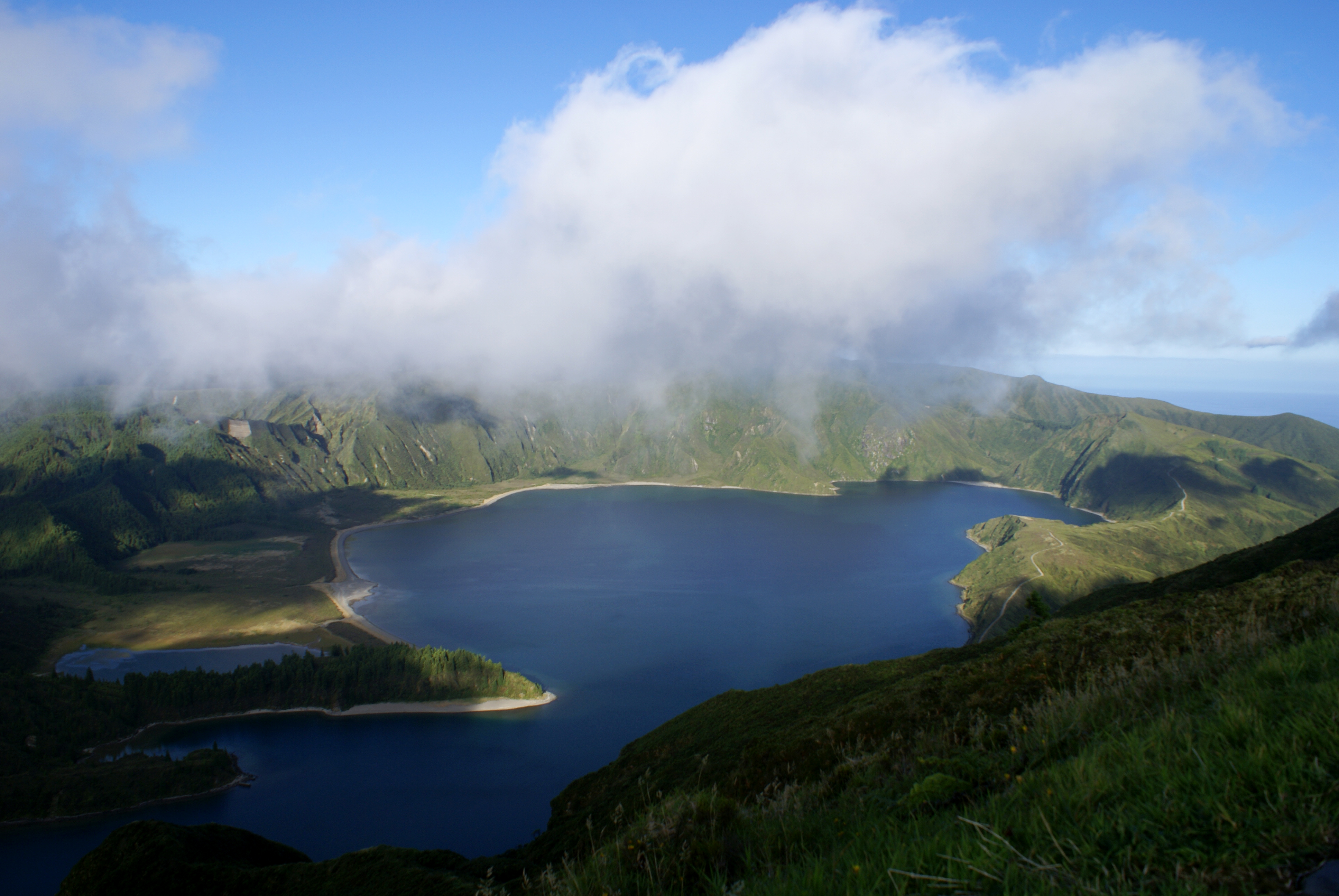
Se as Sete Cidades são a lagoa famosa dos Açores, a Lagoa do Fogo é a lagoa selvagem. Menos visitada, mais remota, e de uma beleza que parece intocada pela mão humana. Escondida na cratera do vulcão de Água de Pau, a 580 metros de altitude, esta reserva natural tem umas águas de um azul tão intenso que parece irreal — e uma vegetação densa de espécies endémicas que a rodeia como um manto verde.
O que é a Lagoa do Fogo?
A Lagoa do Fogo preenche a cratera do vulcão de Água de Pau, o mais jovem da ilha de São Miguel com cerca de 15 mil anos. Com 580 metros de altitude, é a lagoa mais alta dos Açores e também uma das mais protegidas: todo o território envolvente é uma Reserva Natural Parcial.
O nome "Fogo" refere-se à origem vulcânica da cratera, não a qualquer atividade atual. A lagoa está fria mesmo no verão e as suas margens são inacessíveis sem fazer o trilho completo.
Como chegar à Lagoa do Fogo
De carro (outubro a meados de junho)
Pela EN5-2A, a estrada montanhosa que liga Lagoa (sul) a Ribeira Grande (norte). Muito sinuosa e estreita — conduz com cuidado. Dois miradouros com estacionamento gratuito ao longo da estrada. A partir de Ponta Delgada, cerca de 21 km e 30 a 40 minutos.
De shuttle (meados de junho a final de setembro)
No verão, o acesso de carro está proibido entre as 9h00 e as 19h00. O shuttle parte dos parques de estacionamento na base da montanha e custa 5 euros (gratuito para crianças até 6 anos e residentes açorianos). Os horários estão disponíveis na app VisitAzores.
Dica: No verão, chega ao ponto de partida do shuttle antes das 9h00 ou planeia a visita para depois das 17h00 para evitar filas.
O trilho PRC02-SMI
O trilho "De Praia a Lagoa do Fogo" é a única forma de chegar à margem da lagoa. Começa na aldeia da Praia (costa norte) e tem 11 km de extensão linear. O tempo médio é de 4 a 5 horas de ida e volta — planeia pelo menos 6 horas no total.
O trilho é de dificuldade média-baixa, mas tem um desnível acumulado significativo. A chegada à margem da lagoa, depois de caminhar entre fetos gigantes e vegetação densa, é um momento que fica na memória.
Importante: O trilho é linear — não circular. Tens de ter transporte no ponto de chegada ou regressar pelo mesmo caminho.
Alternativa: o miradouro da estrada
Se não tiveres condição física ou tempo para o trilho completo, o miradouro junto à EN5-2A já oferece uma vista fantástica. Muitos argumentam que a vista da lagoa na íntegra, com toda a cratera visível, é ainda mais bonita do miradouro do que estando dentro dela.
A reserva natural: flora e fauna endémicas
A área em torno da Lagoa do Fogo é um dos últimos refúgios da flora endémica dos Açores. Aqui crescem espécies que não existem em mais lugar nenhum do mundo, como a Picconia azorica (pico-pau), a Ilex azorica (azevinho dos Açores) e diversas orquídeas selvagens. O priolo (Pyrrhula murina) e várias espécies de tentilhões endémicos encontram aqui o seu habitat.
Dicas práticas
- O tempo muda muito rapidamente: o nevoeiro pode cobrir a lagoa em minutos. Leva sempre capa de chuva.
- Calçado impermeável com boa aderência é indispensável para o trilho, especialmente após chuva.
- Não há infraestruturas na margem da lagoa: nem restaurantes, nem casas de banho. Leva tudo o que precisas.
- A lagoa tem água muito fria mesmo no verão — não está preparada para banhos.
- A fotografia é melhor nas primeiras horas da manhã ou ao fim da tarde.
- Não deixes lixo: a reserva natural é um ecossistema frágil.
Quando visitar
A melhor época é de maio a outubro. Maio e junho são excelentes: a vegetação está exuberante, as flores endémicas estão em flor, e há ainda poucos turistas. No inverno há dias absolutamente cristalinos em que a lagoa brilha como nunca — e é provável que a tenhas praticamente para ti.
A Lagoa do Fogo exige um pouco mais de esforço do que outros pontos turísticos de São Miguel — e é exatamente esse esforço que a torna especial.